

At the beginning of the 1960s, it was said that we knew more about the landscape of the Moon than the ocean floor. But during the Cold War, nuclear submarines needed accurate maps of the ocean floor. This led to the development of ocean floor maps.
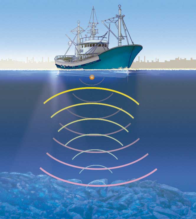
Detailed maps of the ocean floor are created using sonar. Sonar sends out sound waves and measures the time it takes for the echo to return from an object. From this measurement, the distance of objects can be calculated in order to map the surface of the ocean floor. This map shows the main ocean floor landforms.
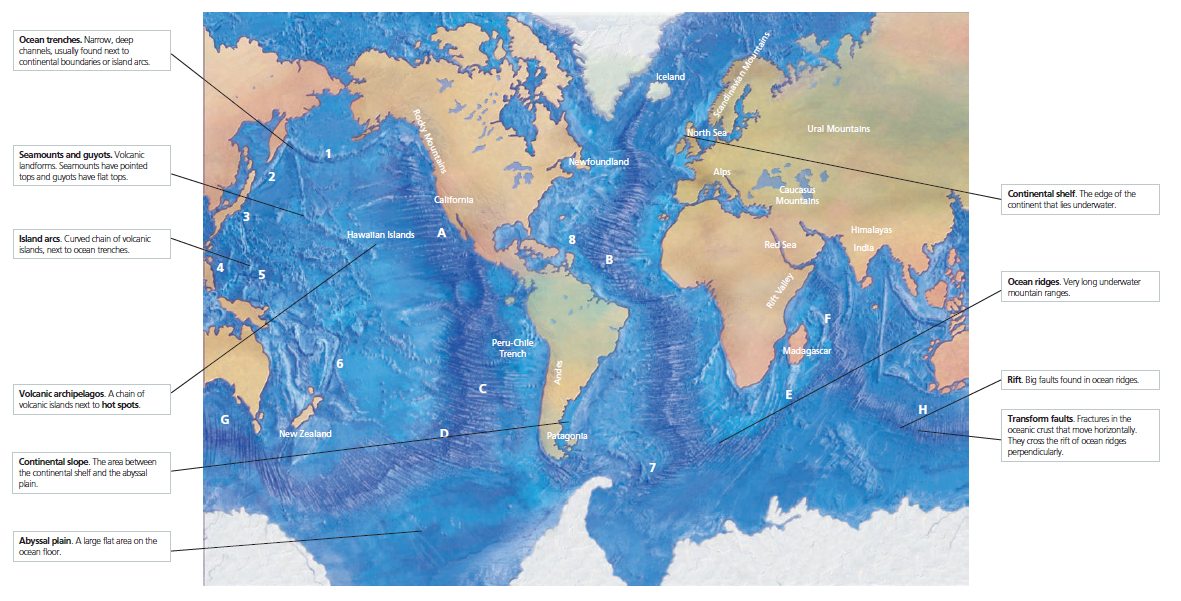
The use of sonar, deep sea drilling and the marine magnetometer has completely changed our vision of the ocean floor and our understanding of the dynamics of the Earth. Maps of the ocean floor show that there are many different landforms, from flat plains (abyssal plains) to large volcanic mountains. Notable landforms are the Mid-Ocean Ridge and ocean trenches.
Maps also show big differences between different oceans, especially between the Atlantic and the Pacific.
The Atlantic Ocean does not have many trenches, while the Pacific Ocean is almost completely surrounded by a large network of trenches. Some of these trenches are located along the continent; and some are located next to island arcs and inland seas.
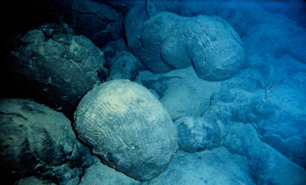
Before our exploration of the oceans, some scientists believed that the oceans were huge bowls that filled up with sediment. However, areas were found with no sediment or with a very thin layer.
During the 1960s, several oceanographic expeditions, such as the DSDP (Deep Sea Drilling Project), took samples from the ocean floor that revealed new information:
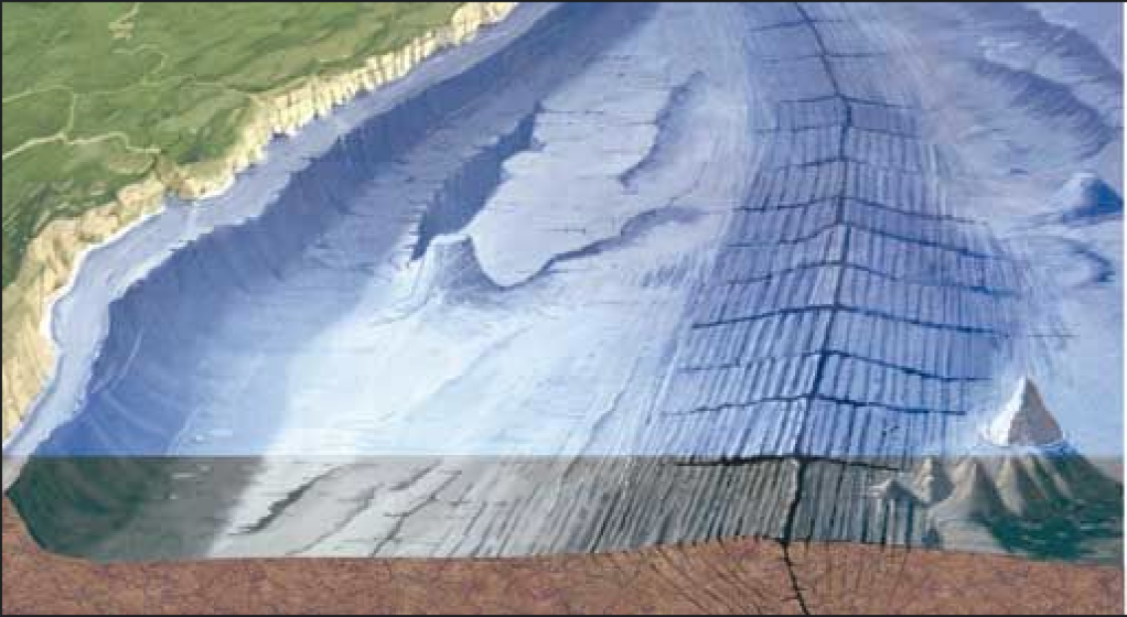
The diagram below shows the differences between the oceanic and continental crust.
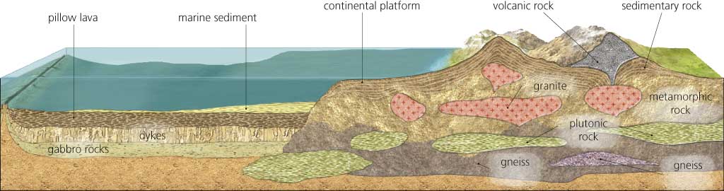
The diagram also shows that the continental crust is not only the areas of the continents above water; it also occupies the underwater shallow areas that surround them, such as the continental shelf.
Activity 25
Apply
Activity 26
Understand
Activity 27
Analyse
Activity 28
Create
Activity 29
Analyse
Activity 30
Analyse
Activity 31
Create
Activity 32
Create

