We use cookies to improve and analyse your browsing experience on our web. You can accept these cookies, reject them or choose your settings by clicking on the corresponding buttons. Please note that rejecting cookies may affect your browsing experience. For more information you can consult our Cookies policy.
Cookies are an essential part of how our web works. The main goal of cookies is to make your browsing experience more comfortable and efficient and to improve our services and the web itself.
Here you can find all the information about the cookies we use and you can activate and/or deactivate them according to your preferences, except for those cookies that are strictly necessary for the operation of the web. Blocking some cookies may affect your experience on the web and how the site works. For more information you can visit our Cookie Policy.
These Cookies are necessary for the web to function and cannot be disabled on our systems. They are generally only set up in response to actions you may take such as requesting services, setting your privacy preferences, logging in or completing forms. You can set your browser to block or warn you about these cookies, but some parts of the web will not work. Information about Cookies.
These Cookies allow us to count the number of visits and traffic sources so that we can measure and improve the performance of our site. They help us to find out which pages are the most popular and least popular, and to see how visitors move around the web. All information collected by these Cookies is aggregated and therefore anonymous. If you do not allow these Cookies we will not know when you visited our web. Information about Cookies.
These cookies are used to analyse your activity in order to show you personalised advertisements. Information about Cookies.
Change theme

Revision mode

The risk not only depends on the intensity and the frequency of the phenomenon, but also on the density and size of the population and the type of infrastructures in the place affected.
Risk = danger (Probability that the phenomenon happens in this place at a certain time.) × vulnerability (Value of the damage that people, or their belongings, can suffer as a consequence of the phenomenon).
So, in an uninhabited area, the risk is zero. However, in an area with medium danger but a very high population density and poorly designed infrastructures, the risk can be the similar to an area with high seismic danger that has buildings designed to resist earthquakes.
Earthquakes and explosive volcanic eruptions are the internal geological phenomena that cause the most victims and material damage.
Every year there are close to a million earthquakes; about 150000 are felt by the population and the rest only by seismographs. To evaluate the strength of earthquakes, there are two types of measurements: magnitude and intensity.
An earthquake will only have one value of magnitude, but its intensity will vary depending on the area where it is measured: the maximum is found in the epicentre and decreases further away from it.
The main risk of earthquakes is the movement of the ground and the collapse of buildings, as occurred in 1976 in Tangshan, China, where more than half a million people died. Other historic examples of the effects of an earthquake are the following:
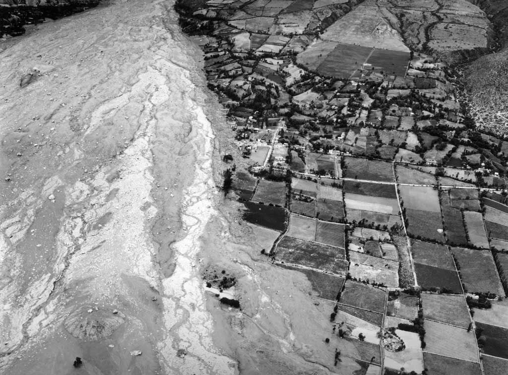
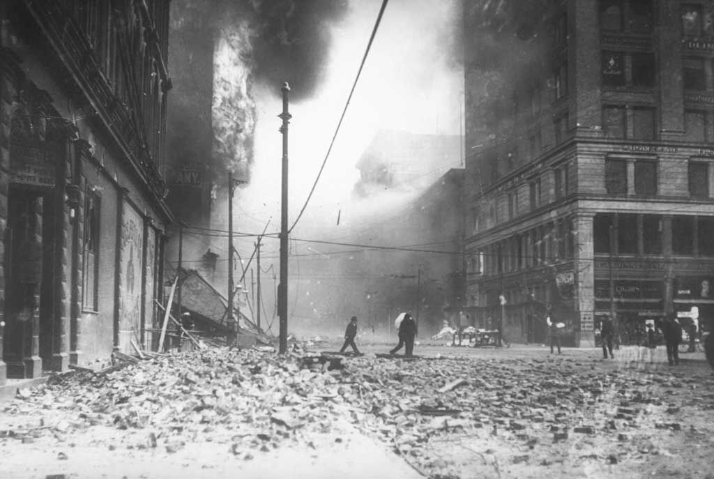
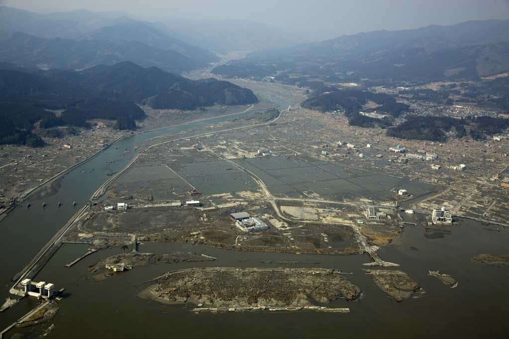
The Iberian Peninsula is situated near the contact region of the African and the Eurasian plates, although it is not a very active area.
As a result, there is a moderate seismic risk, less than in most other Mediterranean countries. This means that there are earthquakes which are felt by the population and more rarely, others that cause considerable damage.
Catastrophic earthquakes in this area cannot be ruled out, such as the one in Arenas del Rey (Granada) in 1884, which caused more than 1 000 deaths, or the most recent one in Lorca (Murcia) in 2011, which caused nine deaths.
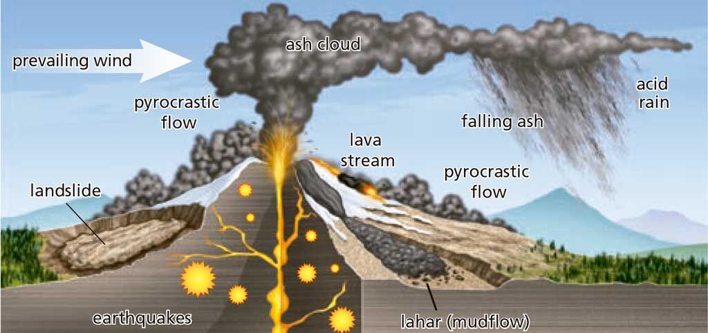
The risks associated with volcanic activity are quite varied, as you can see in the following figures and examples:
We are still very far away from being able to predict the day and time that the next earthquake will occur. We do not even have reliable indicators that tell us how close it is. But we do know that where there have already been earthquakes of some intensity every certain amount of time, they will continue to happen with a similar intensity and regularity.
The elastic rebound theory can help us to have an approximate idea of the areas of a fault that are susceptible to displacement soon.
Earthquake prediction is based on measuring the accumulated pressure in the rock near the faults or detecting the microfractures that sometimes appear before the main displacement. These microfractures produce changes in the magnetic and electrical properties of the rocks and allow certain gases to escape, such as radon.
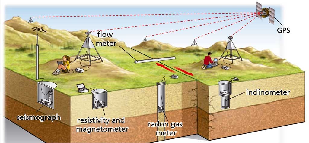
Volcanic eruptions can be predicted with a certain amount of accuracy, provided we have the instruments and people monitoring them. This is done by registering the signs that magma is accumulating in the magma chamber and then the factors that allow it to rise towards the surface. When this occurs, a series of micro-earthquakes known as volcanic tremor take place.
Another important source of indicators is the measurement of the amount, composition and temperature of the gases and thermal springs released by the volcano before eruption.
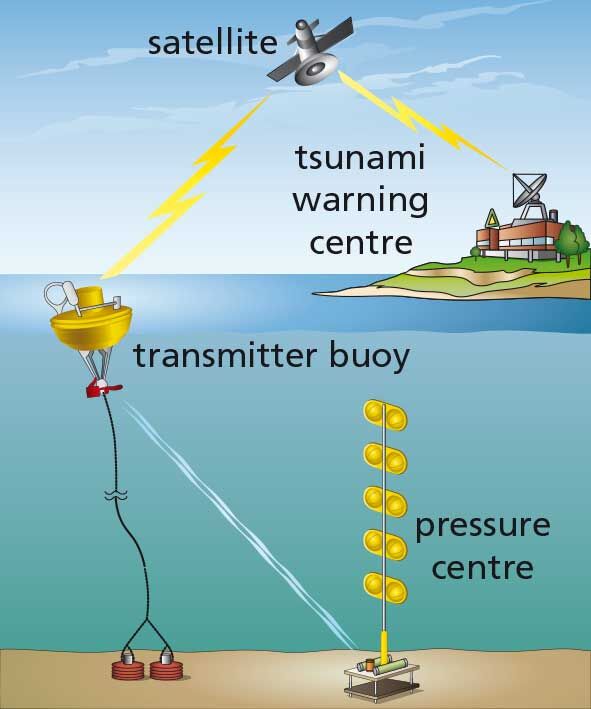
Although we cannot stop earthquakes or volcanic eruptions, it is possible to take decisions that reduce the risk or take measures that lessen the damage caused. The risk formula doesn't include the reduction of the danger but it does include the reduction of vulnerability. For example, we can lessen seismic risk by not constructing buildings on poorly consolidated sediments, or by reinforcing them with iron or reinforced concrete for better resistance to the movement of the ground.
The first step is to determine the seismic or volcanic risk in the area and make maps showing the danger. Then, prevention is worked with in three areas in order to reduce the vulnerability or exposure to that phenomenon:

conjunction not only... but also:
The risk not only depends on... but also on...
Activity 35
Find out if an earthquake with a magnitude of 6 is twice as strong as one with a magnitude of 3. If not, how much stronger is it? Select the right answer.
Activity 36
Explain how the following factors will affect personal and material damage caused by an earthquake:
Activity 37
Look at the map. Listen and answer the questions.
Activity 38
Explain why lava flows are an important volcanic risk.
Activity 39
The VEI is used to measure the danger of an eruption. Look at the graph and answer the following questions.
Activity 40
Look at the diagrams and explain how an earthquake is produced according to this theory.
Activity 41
Find out what instruments are used to predict earthquakes and volcanic eruptions. Then select the instruments used from the following list.
Activity 42
Investigate the difference between earthquake precursors and aftershocks. What importance do each of these have? Then categorise the different sentences by placing them under their correspongding section.
Activity 43
Discuss the difference between our knowledge and techniques to predict volcanic eruptions and earthquakes.
Activity 44
The earthquake that hit India in 1993, of magnitude 6.4 on the Richter scale, caused 30 000 deaths. A year later, another earthquake of the same magnitude occurred in California, but only caused 63 deaths, although it also affected a densely populated area. How can you explain this difference?
Activity 45
Complete the table to compare the different damages associated with both earthquakes and volcanic eruptions.
Activity 46
Why is it so important in the prediction and prevention of earthquakes to know in detail the history of earthquakes on a fault line?
Activity 47
Discuss the reasons why earthquakes have been a much more destructive geological phenomenon than volcanic eruptions.

